



TULSA, OKLA. — El Niño is the cyclical warming of the equatorial waters in the eastern Pacific Ocean, which occurs every two to seven years. This oscillation in the currents known as ENSO, (El Niño Southern Oscillation) dictates not only water temperature at the surface, but prevailing winds, air temperature and weather patterns worldwide.
Climate scientists started seeing a trend toward El Niño this year months ago as sea surface temperatures began to warm from our most recent La Niña (which refers to the cooler than average waters over the same ocean region). Long-range computer models now consistently show a very strong El Niño developing, which is defined as warming beyond 2° Celcius above average. The downstream impacts are dictated by the strength of the El Niño pattern that can last for up to 2 years. It starts with a change in strength and even direction of the trade winds above this region of water. The "Easterlies" weaken and sometimes can even reverse. This has many impacts beyond this Tropical region of the planet.
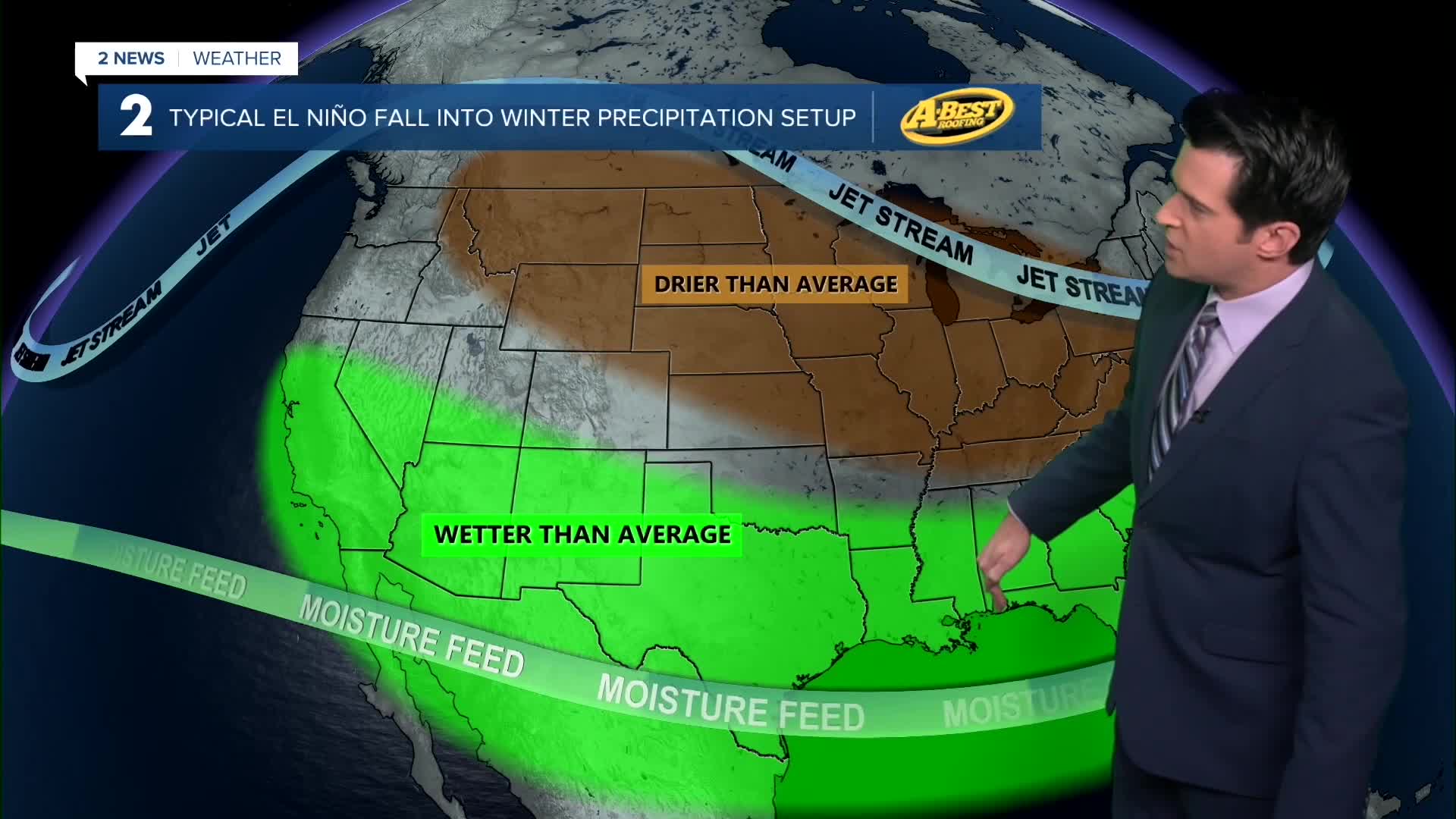
A typical El Niño fall into winter temperature setup features warmer than average temperatures across the northern half of the United States and cooler than average temperatures across the extreme southern United States. In terms of a typical El Niño precipitation setup, that tends to feature wetter than average conditions across the southern part of the country and drier than average across the northern half.
The Climate Prediction Center for the rest of September, October, and November is predicting above average temperatures for a big chunk of the country, especially in the Pacific Northwest and in southern Florida. Regarding precipitation, an above average signal is showing up, especially over the four corners region and in the southeast.
The CPC is predicting above average temperatures for December, January, and February across the northern half of the United States. For precipitation chances, an above average signal is noted across the southern part of the country, including Oklahoma.
For Oklahoma this fall, we have equal chances for precipitation, but we are favoring towards wet as the season progresses. Drought relief will likely take some time. We are currently in moderate to severe drought across our entire viewing area from southeast Kansas into eastern Oklahoma.
The winter outlook for Oklahoma calls for wetter conditions due to the impacts of a strong El Niño. A wetter winter doesn't mean a snowier one. However, better chances for drought relief from rain (and maybe some snow). The forecast is calling for slightly warmer temperatures, but cold spells are still very possible.
 Facebook
  TikTok
  YouTube
 Instagram
 Threads
 X
X