
*** WINTER WEATHER ADVISORY IN EFFECT UNTIL 3 PM WEDNESDAY FOR TULSA, ROGERS, MAYES, DELAWARE, CREEK, OTTAWA, OSAGE, WASHINGTON, PAWNEE, NOWATA AND CRAIG COUNTIES IN OKLAHOMA. ***
*** WINTER WEATHER ADVISORY IN EFFECT UNTIL 6 PM WEDNESDAY FOR CHAUTAUQUA, MONTGOMERY, AND LABETTE COUNTIES IN KANSAS. ***
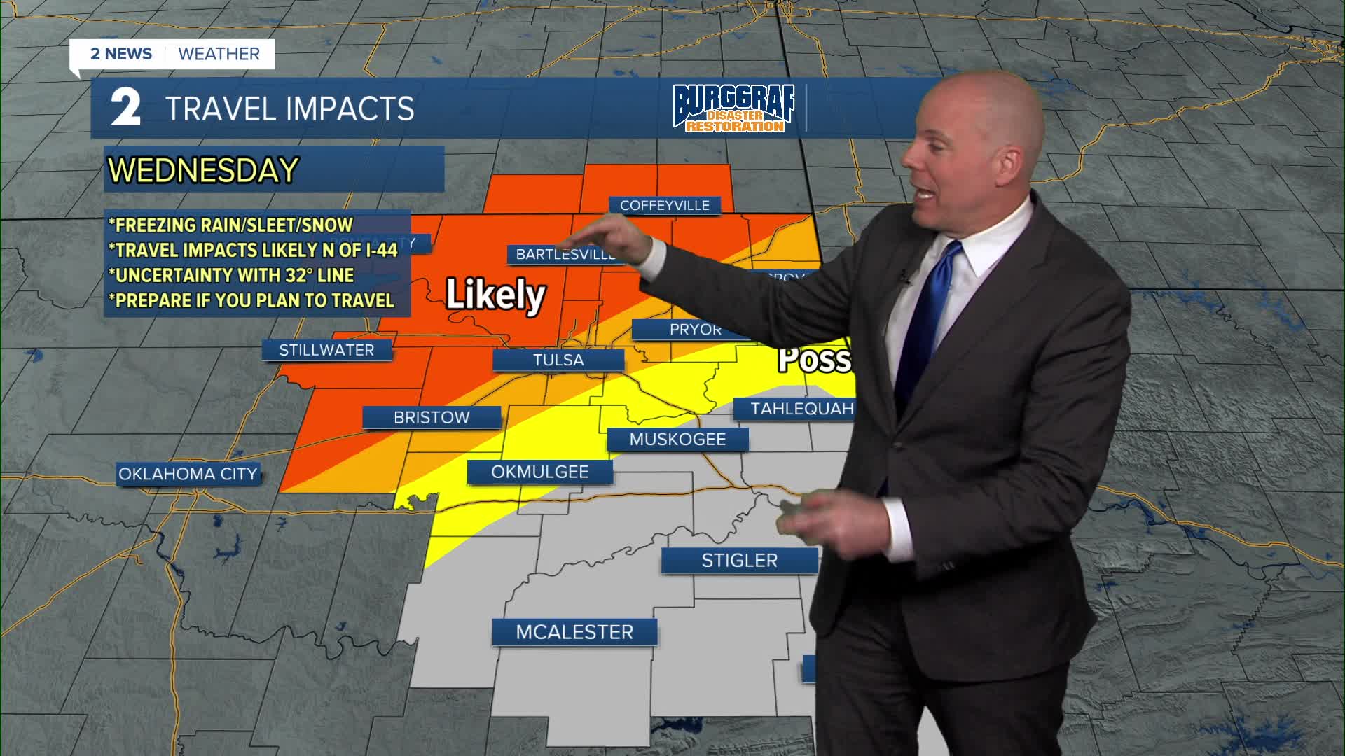
All eyes are on tonight into Wednesday morning as a storm system will bring rain and a wintry mix to Green Country. Timing for the heaviest precipitation looks to be between 3AM and 9AM, but some light precipitation may linger into the afternoon in the form of a few snow showers or flurries.
Highest impacts from wintry weather, including slicks roads, will be in areas under a Winter Weather Advisory, which is from just south of I-44 northward into Kansas. Please plan accordingly if you have travel plans. Ice and snow accumulations should range from a trace in far southern parts of the Winter Weather Advisory to a couple of inches closer to the Oklahoma/Kansas line. Sleet likely limits higher totals, but roads will still be impacted.
Temperatures will slowly drop Wednesday afternoon as colder air filters in. Thursday will be dry but chilly with single-digit wind chill values possible early Thursday morning.
The warmest day in the 7-day forecast just so happens to fall on Valentine's Day with some peaks of sunshine. Highs look to top out in the mid/upper 40s!
Another storm system looks to arrive Saturday bringing rain, with a slim chance a brief change to snow if enough cold air can push in before the precipitation moves out Saturday PM.
Stay tuned as we get closer for the latest details!
Stay in touch with us anytime, anywhere --
- Download our free app for Apple, Android and Kindle devices.
- Sign up for daily newsletters emailed to you
- Like us on Facebook
- Follow us on Instagram
- Follow us on Twitter
