
TULSA, Okla. — Some clouds will filter through overnight with lows by daybreak in the low/mid 40s. A few favored cold spots may even reach the 30s.
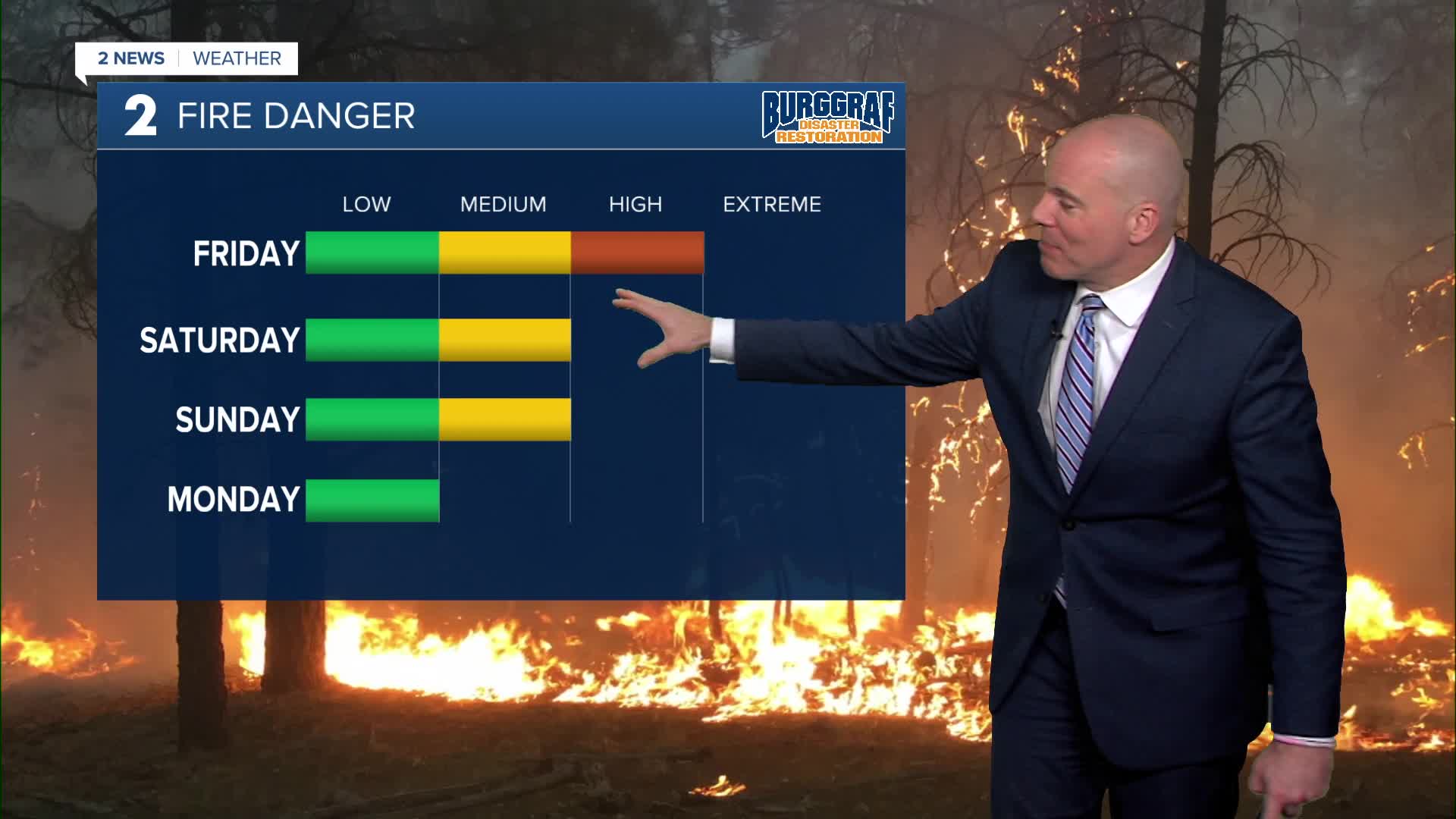
A jacket to start Friday morning, but we warm up in te afternoon with highs back in the low 70s and partly cloudy skies. Unfortunately, gusty winds return with gusts 30-40 mph out of the south to southwest, then shifting out of the west and northwest as another front moves in. The grass fire risk will remain high to critical. No outdoor burning.
For Saturday, lows in the lower 40s, then highs in the low/mid 70s with partly cloudy skies. A storm system will arrive Saturday night into Sunday bringing a chance for a few showers and storms. Right now a few marginally strong to severe storms (hail threat) looks possible. Behind a cold front we'll be a little cooler Sunday with highs in the upper 60s.
Monday and Tuesday looking dry with partly cloudy to mostly sunny skies. Highs in the low 70s on Monday and then mid 70s on Tuesday. Lows in the 40s. Winds don't look nearly as gusty as what we've seen.A nice start to next week!
WATCH 2 News Weather 24/7 on YouTube.
Stay in touch with us anytime, anywhere --
- Download our free app for Apple, Android and Kindle devices.
- Sign up for daily newsletters emailed to you
- Like us on Facebook
- Follow us on Instagram
- Follow us on Twitter
