

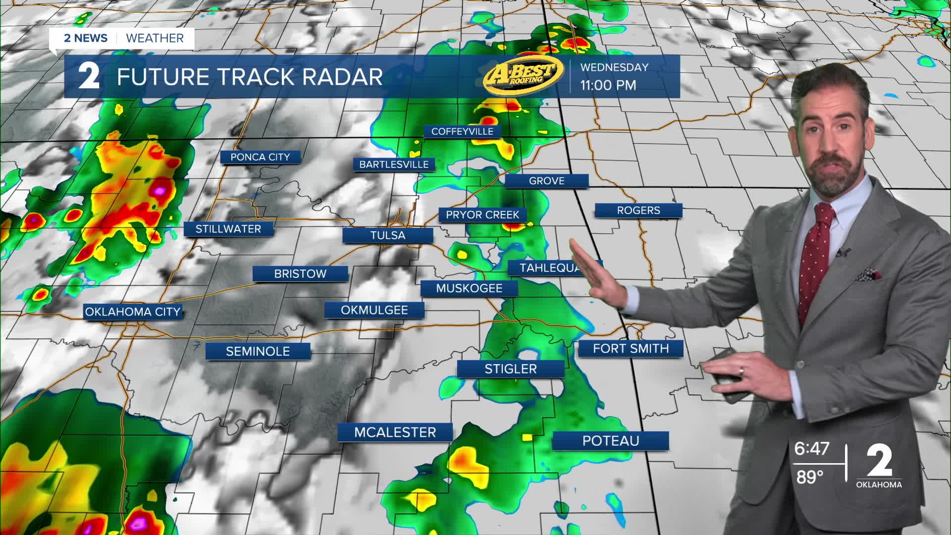


TULSA, OKLA. — A slow-moving, moisture-laden storm system is bringing rounds of rain and storms this evening, overnight and into the start of our Thursday to Green Country. A few storms may be severe posing a risk for damaging wind gusts and even a brief tornado or two. The main concern will be heavy rainfall rates that lead to flash flooding.
A deep supply of moisture will fuel some very heavy downpours. That could lead to localized flash flooding, especially where storms repeatedly move over the same areas.
Thursday will be generally overcast with periods of rain and a renewed chance of t-storms by late afternoon and evening. Temperatures will be in the 70s all day with a light southerly breeze outside of t-storm activity. A few storms may reach severe limits again late Thursday as a cold front arrives.
Showers will remain possible Friday as the front advances southward. The best chance will be south of I-44 in the morning and midday hours.
By Friday afternoon, temperatures may only reach the lower 70s, with a brisk north wind and lingering cloud cover.
Altogether, rainfall between 2" and 4" is likely with some spots getting a bit more or less than that range.
As we head into the weekend, expect skies to slowly clear with any lingering showers gone after Saturday. Temperatures will remain nice and mild with lows around 60° and highs in the 70s.
If you’re headed to the Tulsa State Fair, the fair will start off wet, but the outlook improves considerably after Friday morning, with much more comfortable weather expected for outdoor activities starting over the weekend.
Gorgeous fall weather is with us all of next week with ample sunshine, seasonably mild temperatures and no chance of rain at this time.
 Facebook
  TikTok
  YouTube
 Instagram
 Threads
 X
X